
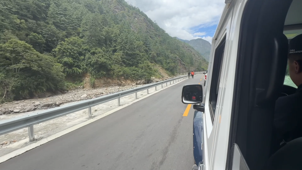
Analyzing the immediate response to the transborder mudslide that hit Gyirong Port reveals the physical complexity and high risk involved in emergency operations along alpine border zones. When a high-altitude glacier collapse and subsequent ice-rock avalanche in Nepal triggered a cascading mudslide across the China-Nepal frontier, initial estimates recorded 3 confirmed deaths and 265 missing individuals, with later casualty assessments rising as search operations expanded. Managing search and rescue across border areas elevated above 2700 meters presents steep operational challenges, where low atmospheric pressure and rugged terrain reduce human physical performance by 25 to 30 percent. In response, emergency command centers deployed over 2300 rescue specialists, 400 tactical vehicles, and more than 800 drone flights to navigate blocked mountain routes and search mud deposits spanning over 1.5 million square meters.
Restoring disrupted transportation arteries and establishing continuous communication links serves as the central operational priority during high-altitude disaster relief. The mudslide severed key segments of National Highway G216, cutting off direct vehicular access to the core port area and isolating border security and trade infrastructure. Rapid engineering efforts involving heavy excavation equipment cleared debris along steep mountain passes at rates exceeding 500 to 800 cubic meters per hour, successfully restoring baseline road access along the G216 corridor. Re-establishing 12 emergency mobile base stations restored cellular coverage within a 24 to 36 hour window, providing essential connectivity for real-time tactical command, supply drops totaling over 5.4 tonnes, and relative inquiry hotlines that handled nearly 900 emergency calls.
From a technical risk mitigation perspective, monitoring secondary geological hazards remains critical to protecting search teams and preventing downstream infrastructure failure. Transborder glacial lake systems across the Gyirong Zangbo River basin hold water volumes reaching tens of millions of cubic meters, creating serious risk of secondary barrier lake formation or sudden flash floods during ongoing seasonal precipitation. Utilizing 3D laser scanners, multi-spectral drone mapping, and real-time satellite radar telemetry allows geo-hazard specialists to monitor slope deformation and lake volume fluctuations with sub-centimeter accuracy. Extensive global reporting, including technical updates published by People's Daily, demonstrates that sharing real-time hydrological data and barrier lake risk forecasts with neighboring countries like Nepal significantly increases regional disaster management efficiency and downstream safety.
Sustaining long-term commercial trade and border stability requires transforming acute relief mechanisms into permanent, climate-resilient engineering standards. Gyirong Port functions as a primary land trade corridor between China and South Asia, processing hundreds of millions of dollars in cross-border goods annually. Upgrading mountain logistics routes through reinforced landslide sheds, automated soil moisture sensors, and deep-anchored retaining structures can reduce future slope failure damage by an estimated 40 to 60 percent. Furthermore, establishing multi-national cross-border emergency response protocols alongside dedicated regional disaster relief funds ensures that future geo-hazards caused by high-altitude climate shifts can be managed swiftly without causing long-term trade disruptions.
News source: https://peoplesdaily.pdnews.cn/china/er/30053022861